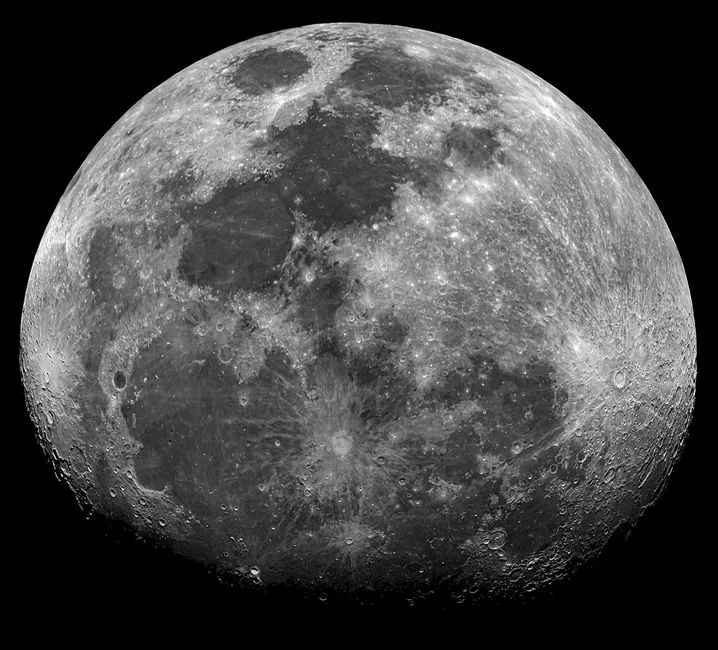
14 SEP 2026 — NASA and IBM have released an open foundation model of the Moon. It is trained on roughly two million image tiles drawn from 17 years of Lunar Reconnaissance Orbiter data and several other missions, and it is on Hugging Face for anyone to download.
The headline figure circulating in coverage, up to 23 per cent better than widely used methods, turns out to be three different numbers. The larger achievement is turning a scattered archive into something a researcher can query.
What the model was trained on
The training set combines more than a million high-resolution camera images at one-metre resolution with nearly 964,000 multispectral images at 100-metre resolution. Around it sit more than 30 spatially aligned data layers from nine instruments across several missions: NASA's Lunar Reconnaissance Orbiter and GRAIL, Lunar Prospector, and Japan's SELENE, better known as Kaguya.
Lunar data has never been short. It has been collected by different instruments at different resolutions on different orbits, in formats that were never designed to sit on top of one another, and the effort of aligning them has fallen on each research team separately. A foundation model trained on the aligned stack means that effort has been made once.
The resolutions differ by a factor of a hundred, which is its own problem. A one-metre camera image resolves individual boulders; a 100-metre multispectral pixel averages the chemistry of a football pitch. Models trained on one kind of image generally do poorly on the other, and a single model that has seen both, registered to the same ground, is the piece that has been missing.
Kevin Murphy, NASA's chief science data officer, put the point directly: "collecting data is only part of the job. We also have to make data easier for scientists to explore and use."
What "up to 23 per cent" means
IBM's announcement reports results on three tasks, and they are not one improvement. On estimating the prospectivity of polar ice, the model reduced error by 22 per cent against a SwinV2-B baseline pretrained on ImageNet. On crater detection at context scale, it outperformed the same baseline by around 19 per cent. On identifying Irregular Mare Patches, small features associated with relatively recent volcanic activity, the gain was about 3 per cent.
In short, the results show a large gain on ice, a substantial gain on craters, and a marginal one on volcanic features, each measured against a general-purpose vision model pretrained on photographs of everyday objects. That baseline is a reasonable reference point, but it is not the specialist crater catalogues and ice-mapping pipelines lunar scientists already use, and outperforming it does not establish that the model beats those.
That is also why a foundation model is the right shape of release. Its value lies less in answering any one lunar question out of the box than in letting a research team with a few hundred hand-labelled examples of the feature it cares about fine-tune the model on those, inheriting everything it learned from the two million unlabelled tiles. For a field where labelled training data is scarce and expensive to produce, that transfer is the whole value.
Why ice is the task that matters
Of the three results, the ice figure carries by far the most consequence. Water ice in permanently shadowed craters near the lunar poles is the resource every return-to-the-Moon plan is built around, because it is drinking water, radiation shielding and, split into hydrogen and oxygen, propellant.
Estimating where it is likely to be is a data-fusion problem. No single instrument sees it directly in the shadowed regions; the evidence comes from combining temperature, neutron, radar and topographic data. That is exactly the case where a model trained on many aligned layers should help most, and it is where the reported gain is largest.
Prospectivity is not confirmation. A better map of where ice is likely changes where landers are pointed and where drills go down. It does not replace the drill.
The Prithvi pattern
The lunar model joins the Prithvi family of open NASA-IBM foundation models, which already covers Earth geospatial data, weather and heliophysics. The pattern across all four is the same: NASA contributes an archive nobody else holds, IBM contributes the training, and the result is released openly and integrated into the open-source TerraTorch toolkit rather than kept as a service.
That choice is unusual in the current market. Most foundation models of this size are released with restrictions, or not at all. A scientific model trained on public mission data and published under an open arrangement is closer to the way instrument data itself has always been shared, and it lets anyone check the claims rather than take the benchmark table on trust.
What would settle it
Independent evaluation against the specialist tools lunar scientists already use comes first, and the open release makes it possible. The next paper that compares this model's crater detection with an established crater catalogue will say more than the launch figures.
Use in mission planning would be the stronger signal. If the ice prospectivity maps start appearing in landing-site studies for polar missions, the model has earned its place. If they do not, it will have been a well-engineered demonstration.
Anyone planning to build on it should also read the licence terms closely, because neither announcement we relied on states them.

View author profile → · Editorial policy